
Flames on the Beartooth Front and Meeteetse Trail
Red Lodge
By Dave Vickery
Photography contributed by the BLM, Forest Service and Stu Hoefle
In June of this year raging flames burst up timbered mountain slopes with the speed, power and roar that resembled an artillery barrage. Trees literally exploded as fire raced skyward through superheated air as towering plumes of smoke punctuated a clear Montana sky. The Robertson Draw fire made its presence known on a historic trace called the Meeteetse Trail which runs along the flanks of the Beartooth Mountain Front.

It ignited on Sunday, June 13. With high winds and unseasonably dry conditions, by June 15th, the fire had quickly grown to 21,000 acres and burned a six-mile swath along the Beartooth Front including Mount Maurice.
The trail owns a colorful charisma of natural and human history and this latest chapter in its storied life is sure to leave a painful lasting mark. The most recent chapter is a massive wildfire which blackened nearly 30,000 acres during weeks of extreme heat and high wind that shut down travel and threatened homes, outdoor recreation and even the town of Red Lodge.
Named the Robertson Draw Fire, it was reportedly caused by human error. It ignited on Sunday, June 13. Local fire units from Carbon County first responded, and shortly afterwards, teams from the Bureau of Land Management, Montana DNRC and U.S. Forest Service were on the scene. With high winds and unseasonably dry conditions, by June 15th, the fire had quickly grown to 21,000 acres and burned a six-mile swath along the Beartooth Front including Mount Maurice. Residents and tourists lined the main street of Red Lodge to stand awestruck as orange flames raced across the face of the mountain. Fortunately, as the fire encompassed the mountain, it spared the town although many rural residents and campgrounds were forced to evacuate.
Hundreds of wildland firefighters, helicopters, air tanker planes and dozens of ground vehicles ultimately joined the battle to contain the intense fire. The fire behavior moderated somewhat in mid-June, but by July, it was only 63 percent contained. As of this writing, the fire is considered 90 percent contained and according to officials, it is likely that firefighting crews will remain on the site until fall weather brings moisture.
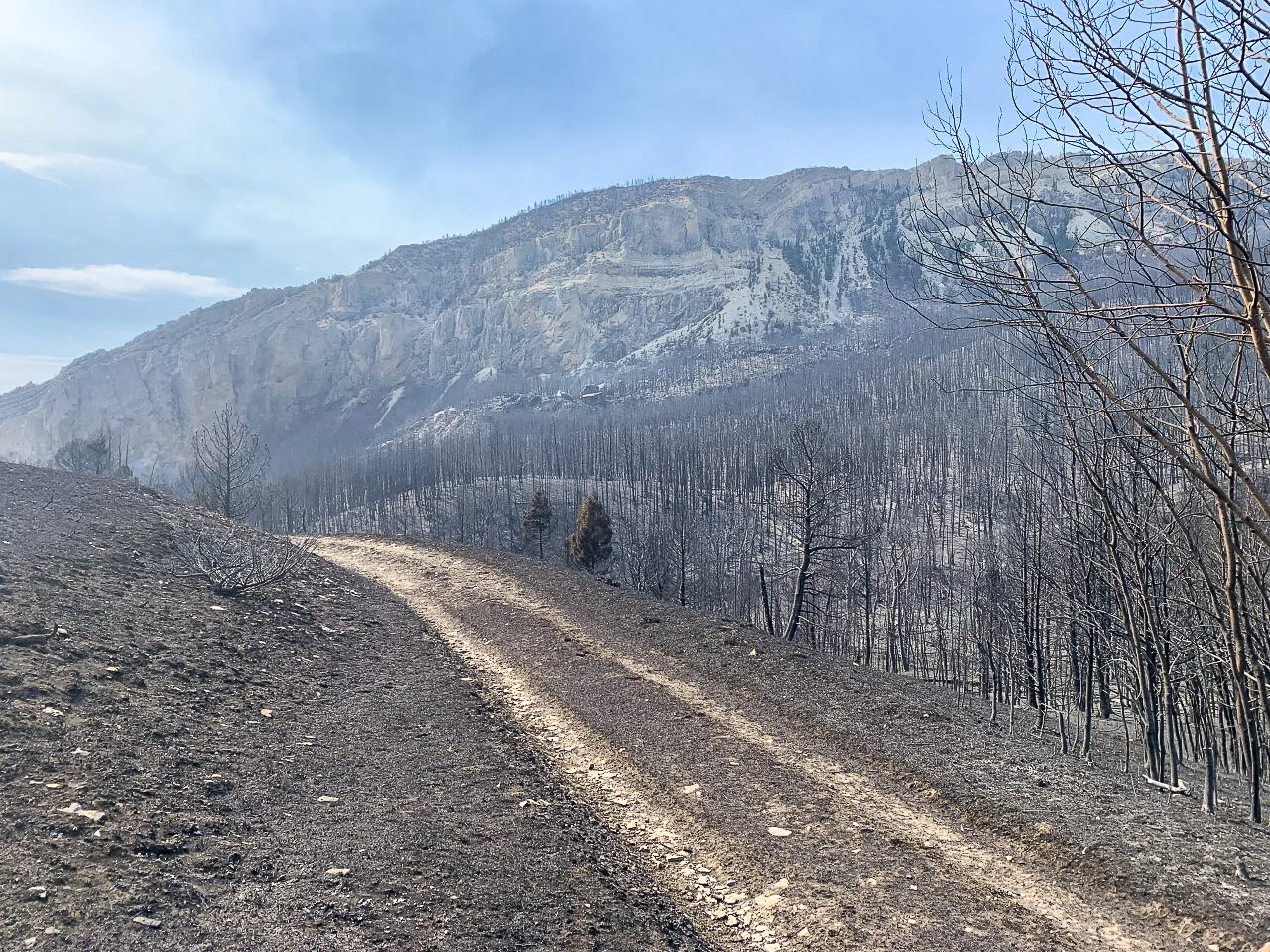
While the mountains, rolling hills and sagebrush flats along the Meeteetse Trail have historically been subjected to wildfires, the Robertson Draw fire will certainly be branded as one of the worst ever recorded. When the fire is finally extinguished, it will leave a dramatically scorched landscape that will last for years.
Given the dramatic loss caused by the Robertson Draw fire, it’s worth noting the history of the trail. The Meeteetse Trail runs from Red Lodge around Mount Maurice and past the rugged drainages of Grove Creek, Robertson Draw, and Line Creek, crossing the Clark’s Fork River and finally to its namesake, Meeteetse, Wyoming nearly 100 miles south. Footprints along the trail were made by ancient hunters, mountain men, outlaws, settlers, and mail stage drivers. The name “Meeteetse” is derived from a Native American term for "meeting place.”


“The Meeteetse Spires Area of Critical Environmental Concern (ACEC) burned in its entirety, including the timbered Grove Creek Gorge as well as Mount Maurice and all the drainage along the front. ”
The history of the Meeteetse Trail is linked to the lives of people who traversed the west. The trail was used over the centuries by Native Americans during their migrations for hunting and settling in seasonal camps. By approximately 1881, the U.S. Army followed the ancient route to establish a travel and wagon route from the Meeteetse area south of Cody along the Greybull River across the Big Horn Basin as a link to the new Northern Pacific railroad terminal at Billings. The original location of Red Lodge was a post office in 1884 at the junction of the Meeteetse trail and Rock Creek, just south of the city boundary today. The trail was first known as the “100-mile route”, and was used by freighters, settlers and travelers from the Yellowstone Valley south to the growing town of Meeteetse, which by about 1890 became a central hub of commerce for the Big Horn Basin.

Colorful and historic people were known to have traversed the early trail, including John Colter as he searched for Indian tribes in 1808 as part of the fur trading expedition for Manuel Lisa. Later, mountain men such as Jim Bridger and Osborne Russell plied their often-dangerous lifestyle across the land traversed by the trail. Buffalo Bill Cody was known to use the route, as were outlaws such as Butch Cassidy and his Wild Bunch. Adventures of various types greeted those who travelled the Meeteetse, often from natures obstacles and weather to, on occasion, people outside the law.
“Residents and tourists lined the main street of Red Lodge to stand awestruck as orange flames raced across the face of the mountain. Fortunately, as the fire encompassed the mountain, it spared the town although many rural residents and campgrounds were forced to evacuate.”
The Robertson Draw fire destroyed a special area that had been set aside to preserve its extraordinary geographic character and rare vegetation. The Meeteetse Spires Area of Critical Environmental Concern (ACEC) burned in its entirety, including the timbered Grove Creek Gorge as well as Mount Maurice and all the drainage along the front.
According to Dave Lefevre, BLM’s Billings field manager, initial study is underway to determine what rehabilitation actions can be taken. Rangeland should start to recover next spring if there is moisture this coming winter and next spring. Restoration of timbered areas will take longer, but according to Lefevre, aspen stands can usually renew themselves reasonably quickly, but the pine forested areas will take a much longer time to regrow. With time, nature will surely reclaim its dominance over the mountains and fill the hills and mountains with the bounty of trees and grass among the spires. Our hope is that she will respond quickly.